Discover the largest, most detailed wall maps that transform any space into a functional learning hub. This guide highlights giant and oversized world maps designed for classrooms, offices, and large living areas. Each option features durability, legibility, and vivid political or physical details to help users explore geography at a glance.
| Product | Size | Lamination | |
|---|---|---|---|
| Maps International Giant World Map – Mega-Map Of The World | 46 x 80 in | Laminate | 1:20m scale; updated 2025; write-on capable |
| Maps International Giant World Map – Classic Large World Map Poster | 46 x 80 in | Laminate | 1:20m scale; classic styling |
| 48×78 World Classic Premier Wall Map Mega Poster | 48 x 78 in | Two-sided lamination | UV coated; dry-erase friendly |
| National Geographic World Wall Map | 46 x 30.5 in | Laminate | Decorator quality; durable |
| Laminated World Map & US Map Poster Set | 18 x 29 in | Laminate | Includes US map; Made in USA |
Maps International Giant World Map – Mega-Map Of The World

The Maps International Mega-Map Of The World is an oversized single-sheet presentation measuring 46 by 80 inches, making it one of the largest world maps available in a single print. The 1:20m scale provides substantial detail for classrooms or large study spaces. The 2025 update introduces refined political boundaries, clearly marked towns and cities, and shaded relief that highlights seas and landforms. Heat-sealed lamination adds durability, allowing writing with dry-erase markers and easy wipe-clean maintenance. This map serves as a bold focal piece while offering daily practical use for geography lessons and discussions.
Key features include a high-contrast color palette to differentiate countries, a straightforward legend, and a design that works well with modern or traditional décor. The laminated surface resists smudges and moisture, which helps in busy classroom environments or high-traffic family rooms. Its sheer size invites students to explore country locations, borders, and connections across continents in a visually engaging way. Installation typically requires a large mounting area or wall-ready anchors due to its substantial dimensions.
Maps International Giant World Map – Classic Large World Map Poster
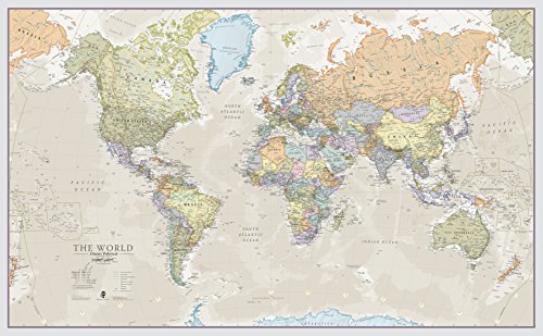
The Classic Large World Map Poster from Maps International mirrors the giant format with a 46 x 80 inch footprint and a 1:20m scale. Its classic styling uses distinct color tones to differentiate nations, enabling quick visual orientation in classrooms, offices, or large living spaces. Laminated for durability, this map is designed for heavy use and easy cleaning. The emphasis on readability makes it well-suited for debate, geography lessons, or wall-mounted reference in spaces where guests and students gather.
In terms of usability, the map’s clear country outlines and legible borders help users track geopolitical changes over time. The laminated finish protects against wear while allowing teachers or families to annotate key locations with non-permanent markers. Its neutral color scheme makes it easy to integrate with varied interior design styles, from modern to traditional. The oversized format does require substantial wall space, but it yields an immersive, educational experience for groups and individuals alike.
48×78 World Classic Premier Wall Map Mega Poster Laminated

The 48×78 World Classic Premier Wall Map offers a nearly monumental display with two-sided lamination for extended longevity. Its giant dimensions make it ideal for large classrooms, conference rooms, or expansive home spaces. The two-sided laminate protects both sides of the poster, allowing for flexible viewing from multiple angles. UV coating adds durability and helps resist fading with prolonged exposure to light, while the dry-erase friendly surface supports frequent updates and activities like geography quizzes or route planning.
The design emphasizes legibility and detail, with clear country borders, coastlines, and shaded relief to highlight topography. The front and reverse sides provide symmetry for different wall arrangements or viewing positions. While installation requires generous wall space and sturdy hanging methods, the result is a striking, interactive geographic tool suitable for ongoing education and decor. This map suits environments where frequent group activities demand durable, wipe-clean surfaces and impressive scale.
Rand McNally Classic Edition World Wall Map – Laminated Rolled

The Rand McNally Classic Edition World Wall Map is a timeless laminated, rolled map designed for dependable classroom and office use. It focuses on clear country identification and modern color-coding to distinguish topographic and political features. The rolled format is convenient for storage when not in use and reduces creasing risks, while lamination provides durability and simplifies cleaning after activities like quizzes or travel planning sessions. This map centers Africa to present a comprehensive view without excessive distortion, supporting study groups and individual learners alike.
Users will appreciate the crisp labeling, legible scale indicators, and a balanced color palette that suits traditional or contemporary décor. The map’s practical size makes it compatible with medium-to-large walls and can serve as a primary reference or supplementary learning aid in classroom settings, libraries, or home study rooms. Periodic updates to border delineations and country names help maintain relevance for ongoing geography education.
ICTEISOM World Map Tapestry Wall Hanging

Unlike rigid posters, the ICTEISOM World Map Tapestry Wall Hanging offers a flexible, room-decor tailored option with a large 80 x 60 inch size. While primarily a tapestry, its map design includes national borders and educational details that can support geography learning in bedrooms, living rooms, dorms, or study areas. The tapestry adds a global aesthetic to space decoration while sparing wall margins from heavy frames or nails. This piece is more about visual engagement and immersion, making it a complementary choice alongside traditional laminated maps.
Educational value comes from the map’s national borders and regional labels, which encourage exploratory discussions about continents, countries, and borders. The textile medium also invites ideas for interactive learning activities, such as map-based storytelling or cultural studies. Its size provides a prominent focal point, though it may not offer the same writing surface or durability as laminated prints. This option is best for spaces prioritizing ambiance and inspiration alongside geography learning.
Buying Guide: Key Purchase Considerations
- Size and wall space: Oversized maps (46 x 80 inches or larger) create immersion but require substantial wall area and sturdy mounting hardware.
- Lamination and durability: Laminated maps resist wear, allow dry-erase writing, and are easier to clean—ideal for classrooms and busy homes.
- Detail and scale: A 1:20m scale typically offers rich political detail and labeled towns; ensure legibility from a comfortable viewing distance.
- Color and styling: Classic tones suit varied décors, while high-contrast palettes improve readability for learners and viewers with visual needs.
- Printing format: Single-sheet giant maps simplify setup, but two-sided lamination or rolled formats can affect installation and placement options.
- Educational alignment: Some maps emphasize political borders; others highlight physical features like terrain shading. Choose based on teaching goals or decor preferences.
- Support materials: Some brands offer updated editions. Check for the latest release to reflect current geopolitical boundaries.
- Value for space: For large classrooms or open areas, pairing a giant map with supplemental smaller maps expands learning possibilities without crowding walls.
When choosing a giant world map, consider how it will serve as a teaching tool, a decor piece, or both. Evaluate your wall dimensions, lighting, and audience to select a map that balances readability, durability, and aesthetic appeal. For multi-user environments, prioritize laminated, wipe-clean surfaces and a layout that minimizes glare and distortion. By understanding each option’s strengths—from ultra-large single sheets to two-sided laminated posters—you can select a map that best fits your space and educational objectives.